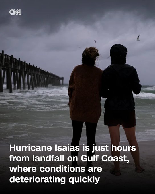
Hurricane Isaias Hours from Gulf Coast Landfall as Conditions Worsen Fast
Gulf Coast, October 9, 2026 — Conditions along the northern Gulf Coast are deteriorating rapidly as Hurricane Isaias, a powerful Category 3 storm, closes in for landfall, with thousands of residents already without power and storm surge beginning to push ashore.
As of late Friday afternoon, the National Hurricane Center reported Isaias packing maximum sustained winds of 115 to 120 mph and centered roughly 90 miles south of Pensacola, Florida.
The storm is accelerating northward at about 17 mph and is expected to make landfall between 8 and 9 p.m. CT near Navarre Beach, just east of Pensacola, still at or near major hurricane strength.
Conditions Already Turning Dangerous
Tropical-storm-force winds have reached the shoreline, with gusts reported near 50 mph in places. Outer rain bands are delivering heavy downpours, and the first measurable storm surge is already affecting low-lying coastal areas. Power outage.
US data showed more than 30,000 customers without electricity across Florida, Alabama, Louisiana, and neighboring states by mid-afternoon, numbers expected to climb sharply as the core of the storm arrives.
Forecasters warn of life-threatening storm surge of 6 to 9 feet above ground in the hardest-hit stretches from the Alabama-Florida border through parts of the western Panhandle.
Rainfall totals of 3 to 7 inches are likely along the immediate coast, with isolated amounts approaching 15 inches possible farther inland.
A tornado watch covers nearly 1.7 million people across the Florida Panhandle, far southeast Alabama, and southwest Georgia.
Communities Brace for Impact
Mandatory evacuations remain in effect in multiple Florida and Alabama counties. Cities including Mobile have imposed curfews.
States of emergency have been declared in Alabama, Florida and Georgia. Travel is disrupted, with airports, bridges, and some rail services suspending operations, while nearly three-quarters of daily Gulf of Mexico oil production has been temporarily halted.
Residents who stayed described a tense atmosphere of darkening skies, rising waves and the first heavy bands of rain. Utility crews from more than two dozen states have already been staged to begin restoration once conditions allow.
Isaias is forecast to weaken after landfall but will still carry strong winds and heavy rain well inland across Alabama and into the Southeast through the weekend.
Flash-flood risks and damaging gusts are expected to extend hundreds of miles from the coast.
Authorities continue to urge anyone under evacuation orders to leave immediately and for those remaining to shelter in place in sturdy buildings away from windows.
Local emergency officials stress that storm surge remains the greatest threat to life.
This is a rapidly evolving situation. Residents along the northern Gulf Coast should monitor official National Hurricane Center updates and local emergency management guidance closely as Isaias makes its final approach.
 news
Court Jails Former Banker 39 Years Over N2.7bn Fraud Case
 news
Sowore Accuses ARISE TV of False Report on Court Hearing with DSS
 news
Sowore Accuses ARISE TV of False Report on Court Hearing with DSS
 sport
Manchester United Back Carrick with More Time Despite Mounting Pressure, Poor Form
 technology
MTN Insists “We’re Not Stealing Your Data” as Furious Customers Cry Foul Over Sudden Vanish
How do you feel about this news?
Community Additions
Have a news tip, correction, or extra context about this story? Post it below instantly. All submissions appear live on this screen immediately.